
The Programme will be implemented in Surkhet, Dailekh, Salyan, Jajarkot, Kalikot, Jumla, Mugu, Dolpa, Humla and (western) Rukum districts in Karnali Province of Nepal. The four highlighted districts are incremental to the HVAP area and will be integrated into the Programme in line with the development of the (i) Chhinchu-Jajarkot–Dolpa; (ii) Surkhet-Kalikot-Jumla-Mugu; (iii) Surkhet- Dailekh road corridors; (iv) Rapti corridor (Salyan-Rukum) and (v) Mid-hill highway. The programme will commence immediately in the six existing HVAP districts and in Mugu, Rukum, Dolpa and Humla being integrated in to the Programme as road access improves.
Districts:
1) Surkhet
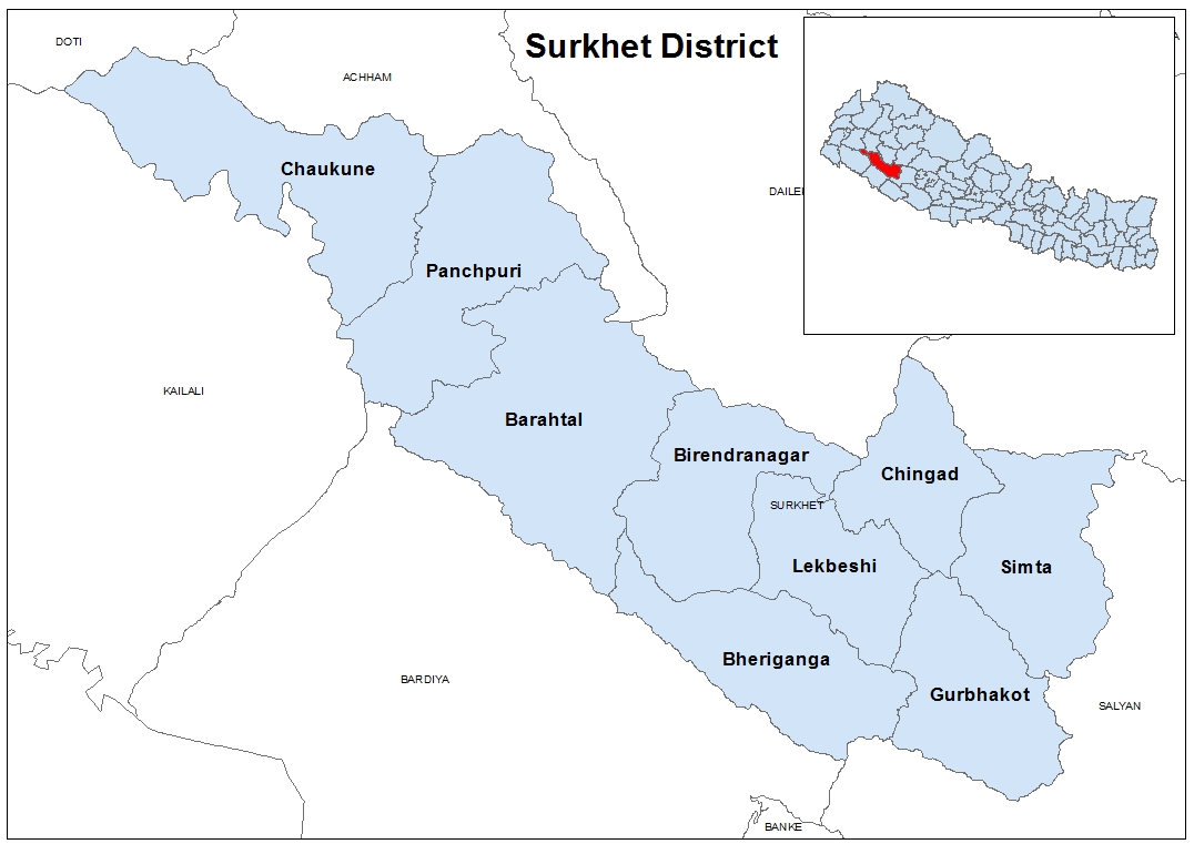
Surkhet District a part of Karnali province, is one of the ten districts of Karnali located about 600 kilometres (373 mi) west of the national capital Kathmandu. The district's area is 2,488.63 square kilometres (960.87 sq mi). It had 288,527 population in 2001 and 343,318 in 2011. Birendranagar is the district headquarters of surkhet and capital of the Karnali state of the new federal republic
Surkhet Valley is one the Inner Terai Valleys of Nepal. Bordering districts are Jajarkot, Dailekh, and Achham to the north, Bardiyabanke district and Kailali to the south, Salyan district to the east, and Doti to the west.
Unlike the cold weather of the Karnali mountain region and hot weather of the Outer Terai region, Surkhet has a more moderate climate. Winter temperatures drop to about 5 °C and in summer it goes up to 38 °C. Monsoon brings sufficient rainfall during the rainy season.
2) Salyan
Salyan District a part of Karnali province, is one of the seventy-seven districts of Nepal. Salyan covers an area of 1,462 km2 with a population of 213,500 in 2001 and 241,716 in 2011. The district's administrative center is named Salyan or Salyan Khalanga.
The district is known for its Hindu temples including Shiva temples in Chhayachhetra and Laxmipur, and the Devi temple at Khairabang in Sarda municipality, one of nine in Nepal.
Salyan was one of the Baise Rajya, a confederation of 22 petty kingdoms in the Karnali (Ghagra) region. About 1760 AD all these kingdoms were annexed by the Shah Dynasty during the unification of Nepal.
3) Jajarkot
Jajarkot District a part of Karnali province, is one of the seventy-seven districts of Nepal. The district, with Khalanga as its district headquarters, covers an area of 2,230 km2[1] and has a population of 171,304 in 2011 Nepal census.[2]
Khalanga is its headquarters. It has 3 municipalities and 4 rural municipalities.[3]
4) Humla
Humla District a part of Karnali province, is one of the seventy-seven districts of Nepal. The district, with Simikot as its district headquarters, covers an area of 5,655 km² and has population of 50,858 as per the census of 2011 .[1] The Northern part of Humla District is inhabited by Buddhists, originating from Tibet, whereas the South is mostly inhabited by Hindus.
5) Rukum
Rukum District is a "hill" and "mountain" district some 280 km west of Kathmandu partially belonging to Province No. 5 and partially to Karnali Pradesh. Rukum covers an area of 2,877 km² with population of 207,290 in 2011 Nepal census. Musikot (also called Jhumlikhalanga) is the district's administrative center.
6) Dolpa
Dolpa District a part of Karnali province, is one of the seventy-seven districts of Nepal. The district, with Dunai as its district headquarters, covers an area of 7,889 km2 (3,046 sq mi) and has a population (2011) of 36,700.[1]
7) Dailekh
Dailekh District a part of Karnali province, is one of the seventy-seven districts of Nepal. The district, with Dailekh as its district headquarters, covers an area of 1,502 km² and had a population of 225,201 in 2001[2] and 261,770 in 2011.[3]
It is said that the name Dailekh is derived from Dadhi Lekh. Dadhi stands for Dadhichi. Dadhichi was a sage in ancient time and Lekh mean hill. Etymologically ‘Dadhi Lekh’ means the hill where sage Dadhichi meditated. [4] [5] There is also an another story about name that, in ancient time it was a place of Devatas, so it called "Daibalok" which later became 'Dailekh'.[4] [5]
Dailekh District was a part of Khasa kingdom during 12th to 14th century.[6] Sinja Valley was the ancient capital city and powerful town of the Khasa Kingdom[7]:76[8] After the fall down of the Khasa Kingdom it divided into many small kingdoms. Before the unification of modern Nepal, the area of the Karnali region had a united kingdom named Baise Rajya (Twenty two principalities). Dailekh principality was one in twenty two principalities.
8) Jumla
Jumla District a part of Karnali province, is one out of ten districts of Karnali. The district, with Jumla as its district headquarters, covers an area of 2,531 square kilometres (977 sq mi) and had a population of 89,427 in 2001 Nepal census and 108,921 in 2011 Nepal census.[3] Jumla is situated in Longitude between 81⁰ 28' E to 82⁰ 18'East and Latitude between 28⁰ 58'N to 29⁰ 30'North.[4]
Nepali language was originated first at Sinja Valley of Jumla district, which known as Khas language then. Sinja was the capital of Khas Kingdom, Therefore, the Nepali dialect "Khas Bhasa" is still spoken among the people in this region.[5]
9) Kalikot
Kalikot District a part of Karnali province, is one of the seventy-five districts of Nepal. The district, with Manma as its district headquarters, covers an area of 1,741 km², had a population of 105,580 in 2001 and 136,948 in 2011. In September 2005, in a bid to encourage a change in social attitudes, the government announced that it would provide rice to any family that had recently had a girl born.[1]
10) Mugu
Mugu District a part of Karnali province, is one of the seventy-seven districts of Nepal. The district, with Gamgadhi as its district headquarters, covers an area of 3,535 km² and had a population (2011) of 55,286.[1] Mugu is known for being both the most remote district in Nepal, as well as the least developed.
सम्पर्क
- कृषि क्षेत्र विकास कार्यक्रम
- वीरेन्द्रनगर, सुर्खेत
- 083-525584, 083-523296
- www.asdp.gov.np
- info@asdp.gov.np


सूचना अधिकारी

सहायक सूचना अधिकारी

© 2024 कृषि क्षेत्र विकास कार्यक्रम. All rights reserved